Looking for a city where you can hit a trail before breakfast and catch a park concert after dinner? In Glendora, outdoor time is part of daily life thanks to foothill hikes, neighborhood parks, and paved river paths. If you are weighing a move, you likely want to know how close these amenities really are, what trade-offs to expect, and how seasons and safety affect your routine. This guide gives you practical checklists, local context, and smart ways to evaluate a home’s access to the outdoors. Let’s dive in.
Why Glendora fits outdoor lifestyles
Glendora sits along the southern edge of the San Gabriel Mountains, which shapes how you spend time outside. You get three overlapping networks: neighborhood parks, multi-use river and basin trails, and foothill trailheads that lead into the mountains. That mix lets you choose casual park time on weekdays and bigger adventures on weekends.
Summer days can be hot and dry in the valley, while higher elevations can be cool and even snowy in winter. Wildfire and post-storm repairs can affect trail access at times, so a little planning goes a long way.
Neighborhood parks for everyday life
Neighborhood and community parks are the backbone of daily recreation. You will find playgrounds, ball fields, small picnic areas, and walking loops used after school and early evenings. If easy park time matters for your routine, look for homes within about a 5 to 10 minute walk.
What to check at a park
- Restrooms, water fountains, and shade near the play area.
- Safety surfacing under playgrounds and general maintenance.
- Lighting for evening use, plus hours of operation.
- Sports-field reservation rules and event schedules.
- Sidewalks, crosswalks, and the walk route from the home.
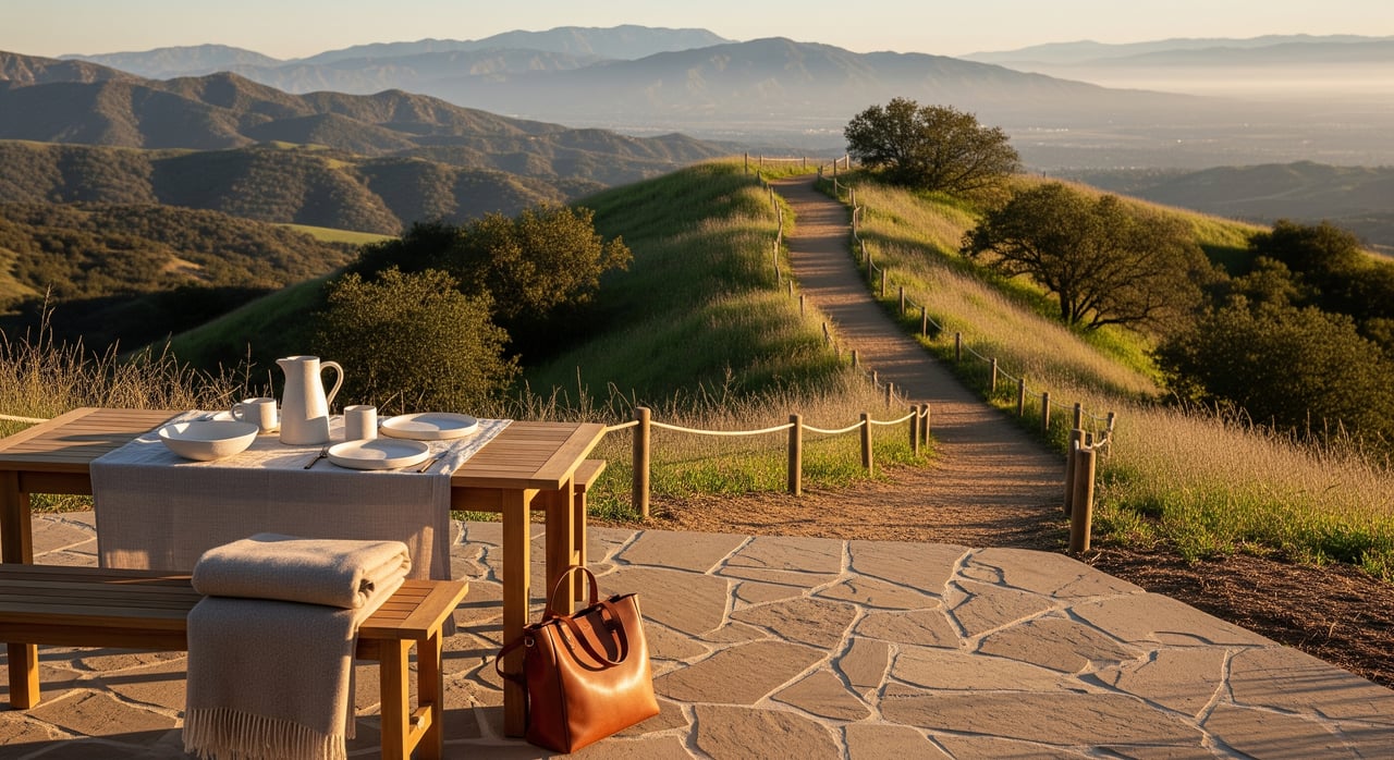
Trails you can reach fast
Foothill trailheads that connect to the San Gabriel Mountains and the Angeles National Forest are typically a short drive from many neighborhoods, often 5 to 20 minutes depending on where you start. These routes support hiking, trail running, and scenic cycling climbs.
Trailheads can fill early on weekends. Expect limited parking during peak hours and plan for weekday mornings if you prefer quieter conditions. Trail conditions, closures, and wildfire restrictions are managed by the U.S. Forest Service for the Angeles National Forest. Always check the latest agency alerts before you go.
Trailhead tips for weekends
- Arrive early and know a backup parking option.
- Read posted parking rules to avoid citations.
- Verify current trail status and weather before you drive.
- Carry water and sun protection, even on cooler mornings.
Paved paths along the river
Multi-use river and basin trails offer flatter routes for bike commuting, stroller walks, and family rides. These off-street paths are a useful counterpoint to steeper mountain terrain. They are popular on weekends, and some segments may close after major storms for repairs or safety.
Bike-ability checklist near a home
- Presence and continuity of bike lanes to the trail access point.
- Quality of sidewalks and safe crossings on the route you would use.
- Elevation changes that affect daily rides with kids.
- Shade, water access, and places to stop and rest.
Bigger weekend recreation nearby
Regional recreation areas tied to the San Gabriel River and nearby reservoirs offer picnic spots, open lawns, and access for activities like fishing or boating where permitted. Hours, fees, and reservations vary by jurisdiction. Confirm whether a site is city, county, state, or federal before planning a group outing.
Lifestyle trade-offs to weigh
Living next to high-demand outdoor amenities has upsides and trade-offs. Being near a popular trailhead delivers instant access but can bring weekend parking spillover, early-morning traffic, or event noise. Hillside or foothill properties can give you views and shorter drives to the mountains, yet may carry higher wildfire exposure, steeper driveways, and landscape rules. Homes near well-kept parks often attract interest, though properties that back directly to busy parking areas can draw mixed reactions.
Safety, seasons, and planning
Summer heat in the valley and colder mountain conditions in winter can change your plans day to day. Wildfire risk and post-storm repairs may close trails or roads. If you are exploring higher elevations, check for temperature swings or snow and confirm current advisories. For homes near the wildland–urban interface, review local wildfire zones, evacuation routes, and defensible-space guidance.
How to evaluate a Glendora home for outdoor life
Use these quick steps during tours and your inspection window:
- Do a walk test to the closest park at the exact time you would use it. Note crowding, lighting, restrooms, and noise.
- Drive to nearby trailheads on a weekend morning to see real parking and traffic patterns.
- Map and ride the route to a river or basin trail, checking bike lanes and crossings.
- Ask about park hours, field reservations, dog rules, and any HOA or city landscape and lighting restrictions.
- Confirm trail difficulty, elevation gain, and seasonal hazards for your favorite routes.
- Review parking rules around parks and trailheads, including time limits and enforcement.
- Discuss local wildfire exposure and evacuation planning with your agent.
Who Glendora fits
If you want weekday park time and quick weekend access to foothill hikes, Glendora supports that rhythm. Families often value walkable parks for after-school routines. Active adults appreciate short drives to mountain trailheads and the option of flatter river paths for cycling or jogging. If you prioritize biking to errands or weekend rides, neighborhoods with safe connections to multi-use trails can be a strong match.
Your next step
If outdoor access is a top priority in your home search, you deserve a plan tailored to how you live. Reach out for a neighborhood walk-through, a trailhead parking check, or a bike-route review as part of your tour. Connect with Michael Mucino for a friendly consult in English or Spanish.
FAQs
How close are mountain trails from Glendora neighborhoods?
- Many foothill neighborhoods are a short drive from trailheads that lead into the San Gabriel Mountains, often 5 to 20 minutes depending on your starting point and the route.
Are there family-friendly parks within walking distance in Glendora?
- Glendora includes neighborhood and community parks used for playground time and youth sports; confirm your walk time and check for restrooms, shade, and lighting.
Are Glendora trails and parks dog-friendly?
- Many areas allow dogs on leash, while some regional spaces may have designated off-leash zones; always verify current leash rules and seasonal restrictions before visiting.
What should I know about wildfire and seasonal closures near Glendora?
- Agencies may close trails and roads during high fire danger or after storms; check official alerts for the Angeles National Forest and local jurisdictions before heading out.
Will living near a popular trailhead in Glendora cause issues?
- Proximity brings convenience but can include weekend parking overflow, early-morning activity, and event noise; visit at peak times to see real conditions.